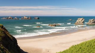
From November to March, Pacific storms roll into the Oregon coast one after another. The regional visitor association, Visit the Oregon Coast, says gusts can top 50 mph and waves can rise above 30 feet. The National Weather Service has issued high-surf advisories for breakers of 25 to 30 feet on the north and central coast. Line a storm up with one of the year's highest tides and the sea comes over seawalls, up blowholes and across US-101.
Storm watching is a real reason to visit in winter: the beaches are quiet and the show is free. Winter is also when the coast is at its most dangerous. This guide covers when to go, the best places to watch from, which ones charge a fee, and the safety rules that matter.
When to Go: Storm Season and King Tides
The storm season runs roughly November through March, and the biggest swells usually arrive in December and January. You get the best show when three things line up: a big swell from a distant storm, strong onshore wind, and a high tide. Watch the forecast, not the calendar. A storm day with a low tide can be tame, and a clear day after a storm with a big leftover swell can be spectacular.
King tides are the highest tides of the year, when the sun and moon line up with the Earth at their closest points. The Oregon King Tides Project, run by the Oregon Coastal Management Program with the Oregon Shores Conservation Coalition, asks volunteers to photograph them each winter to show what higher sea levels will look like. In 2025/26 the Oregon dates were November 5–7, December 4–6 and January 1–4.
 King-tide waves spraying over US-101 at the Depoe Bay seawall. Image: Oregon Department of Transportation, CC BY 2.0, via Wikimedia Commons.
The project hadn't posted its 2026/27 dates on its own site by mid-October 2026. Explore Lincoln City, citing NOAA tide predictions, lists November 23–27, 2026, December 22–26, 2026 and January 20–24, 2027. Treat those as provisional until oregonkingtides.net confirms them. Tide times differ along the coast, so check the NOAA tide table for the town you're visiting.
Depoe Bay: the Spouting Horns
Depoe Bay, which calls itself the world's smallest navigable harbour, sits on a shelf of black basalt right beside US-101. When big swells hit at high tide, water forced into lava tubes and cracks in that rock shoots up through holes in the surface: these are the spouting horns. They go off right next to the seawall downtown, and on big days the spray reaches the cars on the highway.
 A spouting horn erupting through the lava shore at Depoe Bay, photographed in 1938. Image: George A. Grant, Public domain, via Wikimedia Commons.
You don't need to cross anything to see them. Stand at the seawall along the highway, or watch from a window in one of the town's restaurants. People who have climbed over the wall onto the rocks have been killed, so stay on the sidewalk.
The Oregon State Parks Whale Watching Center on the seawall closed in August 2026 for roof repairs and was expected to reopen by late October. Check stateparks.oregon.gov for its winter hours. Gray whales migrate south past Depoe Bay from mid-December to mid-January, so a storm-watching trip can include whale watching too.
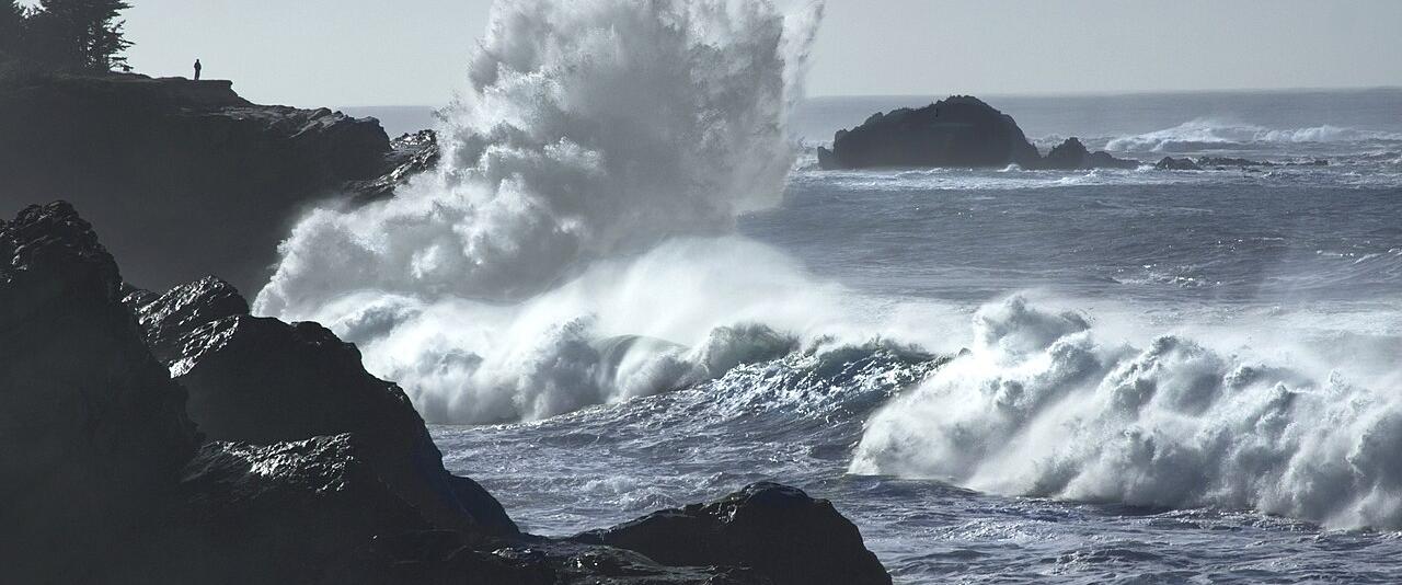
Boiler Bay, just north of town, is a fenced state scenic viewpoint above a rocky bay. It takes its name from the steam schooner J. Marhoffer, which caught fire and wrecked here in 1910; its boiler still shows at low tide. It's one of the easiest places on the coast to watch big waves from the car park.
 King-tide waves breaking at Boiler Bay State Scenic Viewpoint, with spectators at the fence. Image: Cecille Engle Kennedy, CC BY-SA 4.0, via Wikimedia Commons.
Cape Kiwanda, Pacific City
Cape Kiwanda is a sandstone headland at Pacific City, and waves break against it with huge force in winter. You can watch from the beach and the lower part of the big sand dune. The cliff edge is fenced, and the fence is there for a reason. The sandstone crumbles without warning. Seven people died at Cape Kiwanda between 2009 and March 2016, most of them after crossing the fence, and a fall past the fence in 2023 was reported as the eighth fatal accident there since 2009. Oregon State Parks extended the fence after deaths and moved it again in 2019.
 Waves exploding against the sandstone cliffs of Cape Kiwanda. Image: Thomas Shahan, CC BY 2.0, via Wikimedia Commons.
Watch from inside the fence, and don't climb the dune in high wind if you aren't steady on your feet.
Shore Acres State Park, near Coos Bay
Shore Acres is the classic storm-watching park on the southern coast, about 13 miles southwest of Coos Bay near Charleston. It sits on sandstone cliffs about 80 feet above the sea, and the tilted rock layers below send waves straight up when a big swell arrives. An enclosed observation building stands on the site of the old Simpson family mansion, so you can watch from behind glass when the rain comes sideways. Nearby Cape Arago State Park has a gazebo shelter looking out over Simpson Reef.
 Waves breaking over the tilted sandstone ledges at Shore Acres State Park. Image: Finetooth, CC BY-SA 3.0, via Wikimedia Commons.
Shore Acres charges the state-park day-use parking fee: $10 a day for Oregon residents, $12 for out-of-state visitors, valid at any state park all day. A 12-month permit costs $60 for residents and $75 for non-residents. Walkers and cyclists don't pay.
In December the park's formal garden hosts Holiday Lights. The 2026 dates weren't published by mid-October. In 2025 it ran from November 27 to December 31, nightly from 4:30 to 9 pm; entry was free, with a $10 parking fee and timed parking reserved in advance. A storm day followed by the garden lights makes a good winter day trip from Coos Bay or Bandon.
Yaquina Head, Newport
Yaquina Head is a basalt headland north of Newport with Oregon's tallest lighthouse on the tip. The 93-foot tower was first lit in 1873. It's run by the Bureau of Land Management as an Outstanding Natural Area, and in a storm you can watch the swell break around the point from the car park by the lighthouse.
 Storm waves rolling in below Yaquina Head Lighthouse in January. Image: Bonnie Moreland from Oregon, United States, Public domain, via Wikimedia Commons.
Entry is $7 per vehicle for a three-day pass, or $15 for an annual Yaquina Head pass. Federal recreation passes and the Oregon Pacific Coast Passport are accepted, and walkers and cyclists get in free. The interpretive centre is open daily from 10 am to 4 pm, except Thanksgiving and Christmas. Stay off Cobble Beach below the head when the surf is big. See our Newport lighthouse guide for both of the town's lighthouses.
Cape Perpetua, Yachats: Thor's Well and Devil's Churn
South of Yachats, the US Forest Service's Cape Perpetua Scenic Area has three famous wave features within a short walk of each other. Thor's Well is a hole in the rock shelf that fills from below and drains like a sinkhole. The Spouting Horn is another blowhole, at the end of Cook's Chasm, and the Devil's Churn is a narrow inlet where waves pile in and explode. They're at their wildest around high tide in a big swell.
 Water pouring back into Thor's Well on the rock shelf at Cape Perpetua. Image: Joe Mabel, CC BY-SA 4.0, via Wikimedia Commons.
They are also dangerous. A man drowned after falling into Thor's Well in September 2025, the third death there since 2017, according to the Lincoln Chronicle. Every photo you've seen of Thor's Well up close was taken in calm conditions. In a storm, watch from the paved paths and overlooks above the shelf.
 Surf funnelling into the Devil's Churn inlet at Cape Perpetua. Image: Joe Mabel (on Flickr as Joe Mabel from Seattle, US), CC BY-SA 3.0, via Wikimedia Commons.
The Forest Service charges a $5 day-use fee per vehicle (or $30 for an annual pass), and the Northwest Forest Pass is accepted. The visitor centre's winter opening wasn't clear in October 2026, so call 541-547-3289 before you rely on it.
Cannon Beach and Ecola
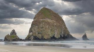
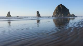
On the north coast, Cannon Beach and Haystack Rock look their most dramatic under low storm clouds, and the town's hotels face straight out to sea. Watch from the dry sand well above the high-tide line or from a hotel window. Don't walk around headlands on a rising tide.
 Haystack Rock and the Needles off Cannon Beach under winter cloud. Image: Gregory "Slobirdr" Smith, CC BY-SA 2.0, via Wikimedia Commons.
Ecola State Park, just north of town, has the best viewpoints over Cannon Beach, but its access road sits on active landslides. Landslides closed the park in December 2025, and it reopened on April 7, 2026. It's on the state parks' fee list. Check stateparks.oregon.gov for closures before you drive up, especially after heavy rain. Our Cannon Beach guide covers the town.
Sneaker Waves: the Rules That Keep You Alive
A sneaker wave is a wave much larger than the ones before it that runs far up the beach with no warning, often after 10 to 20 minutes of smaller surf. At least 21 people died from them in Oregon between 1990 and 2016, and almost all the serious incidents happen between October and April. The National Weather Service offices in Portland and Medford issue Beach Hazards Statements when they're likely. Check weather.gov before you go to the beach.
The official advice:
- Never turn your back on the ocean.
- Stay off logs on the beach and near the waterline. A wave can lift a log weighing tonnes and roll it onto you.
- Stay off jetties, rocks and wave-washed shelves, including Thor's Well, the Devil's Churn and the Depoe Bay lava shore.
- Keep children and dogs well back from the surf.
- If someone is swept out, don't go in after them. Call 911 and keep your eyes on them so you can tell rescuers where they are.
- Respect fences and closures. At Cape Kiwanda and the Depoe Bay seawall they mark where people have died.
Where to Stay and How to Get There
The best storm-watching bases are towns where hotels face the ocean: Lincoln City, Depoe Bay, Newport, Yachats, Cannon Beach and Bandon (for Shore Acres and Face Rock). The Channel House in Depoe Bay, the Overleaf Lodge in Yachats and the Headlands Coastal Lodge in Pacific City are among those that promote storm watching, but check current offers directly. For more on the beaches themselves, see our Oregon coast beaches guide, our Newport guide and our Bandon guide.
US-101 is the coast road. In winter storms it can be closed by landslides, flooding or fallen trees; in January 2023 a slide south of Port Orford dropped the road by up to 12 feet and closed it for four days. Check ODOT's TripCheck.com before you set off and again before you head home. If you're crossing the Coast Range or the Cascades to get there, read our winter driving and road conditions page. For more winter ideas, see winter trips in Oregon.
Bring waterproofs, a hat that won't blow away and a towel for the car. The best seat is often your hotel window with a hot drink.