Crater Lake
The deepest lake in the US; the trail down to the water is closed until 2029
How the lake formed
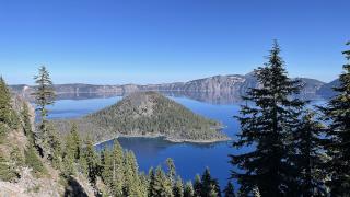
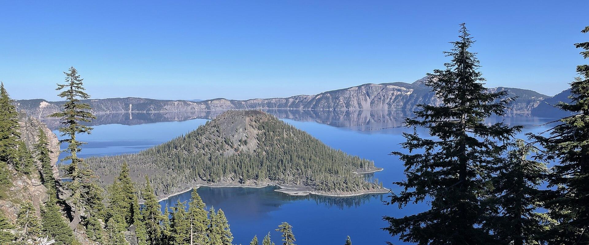
About 7,700 years ago, Mount Mazama erupted so violently that its summit collapsed, leaving a caldera about 5 miles across. Over the following centuries, rain and snowmelt filled it to form today's lake, 1,943 feet deep at its deepest point. Because no streams flow in, little sediment reaches the water, which is among the clearest in the world. Later eruptions built Wizard Island, a cinder cone that rises about 750 feet above the lake near the west shore. The Phantom Ship, a small rock island on the south-east side, is much older: a remnant of lava about 400,000 years old that survived the collapse.
Rim Drive and the viewpoints
The 33-mile Rim Drive circles the caldera with more than 30 viewpoints. It is the main way to see the park, usually fully open from July to late October and closed by 1 November at the latest. Highlights include Discovery Point and the Watchman, near Rim Village, for views of Wizard Island; Cloudcap Overlook, the highest point on the drive; and Phantom Ship Overlook. Good walks from the rim include the Watchman Peak trail, about 1.6 miles round trip to a fire lookout, the climb up Mount Scott, the highest point in the park, and the Plaikni Falls trail to a waterfall. The East Rim Drive has been partly rebuilt, with work due to finish in 2027, and in 2026 the Pinnacles Road was open only to walkers and cyclists.
The lake shore: closed until 2029
The Cleetwood Cove Trail, a steep 2.2-mile round trip, is the only legal route down to the water. It is closed for the 2026, 2027 and 2028 seasons while the park rebuilds the trail, its retaining walls and the boat dock, and is planned to reopen in summer 2029. During the closure there are no boat tours, no Wizard Island trips and no swimming. When it reopens, expect cold water: the surface reaches only about 55–60°F in summer.
Where to stay and eat
Crater Lake Lodge, on the rim, is open from about mid-May to early October and books up early; the Cabins at Mazama Village, near the south entrance, are the other option inside the park. There is no fuel in the park, so fill up in Medford, Klamath Falls or along Highway 62.
Getting there
From Medford, about 80 miles and an hour and a half, Highway 62 leads to the west entrance; Rogue Valley International airport in Medford is the nearest major airport. From Klamath Falls, about 60 miles, take US 97 and Highway 62 to the south entrance. Both are open all year, and the road from them to Rim Village is ploughed. The north entrance, on Highway 138 towards Bend, closes in November and reopens between mid-May and late June, depending on snow. In winter, chains or traction tyres are required.
Fees
Entry costs $30 per vehicle for seven days from 22 May to 31 October and $20 in winter. Crater Lake is not one of the 11 parks that charge international visitors the $100 nonresident fee introduced in 2026.
Winter
Snow covers the park for much of the year, and in winter Rim Village is the only part of the rim you can drive to. Ranger-led snowshoe walks and cross-country skiing on the snowed-over Rim Drive are the main activities, and on a clear day the view of the snow-rimmed lake is one of the best in the park.
Best time to visit
July to September, when Rim Drive and the north entrance are open. The Cleetwood Cove Trail to the lake shore is closed until summer 2029, so there are no boat tours or swimming until then.
What to see in Crater Lake
Our picks first.
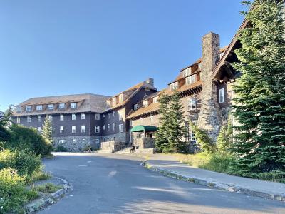
Crater Lake Lodge
Historic 1915 lodge with deep blue caldera views
Architecture · National Parks
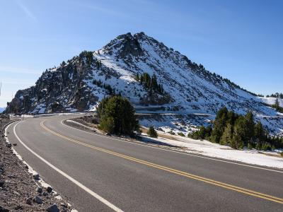
Rim Drive
33-mile scenic loop around Crater Lake rim with over 30 pullouts
Natural Wonders · National Parks
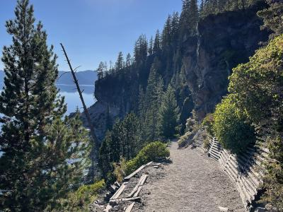
Cleetwood Cove Trail
The only trail to Crater Lake's shore, closed for rebuilding until 2029
Natural Wonders · Recreation & Sports
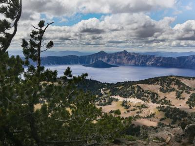
Mount Scott
Highest point in Crater Lake National Park with historic fire lookout
Natural Wonders · Recreation & Sports
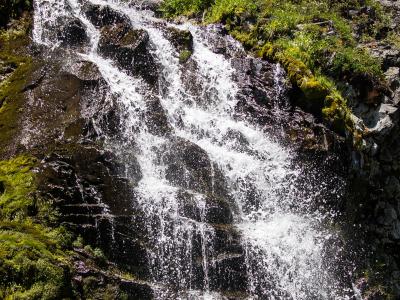
Plaikni Falls
Gentle 2-mile hike through old-growth forest to snowmelt-fed waterfall
Natural Wonders · Hiking Trails
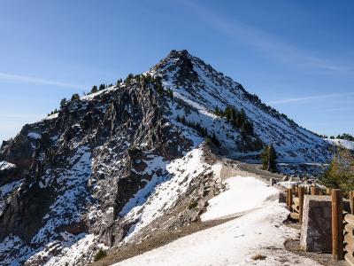
Watchman Peak
Western rim summit with panoramic views of Crater Lake and Wizard Island
Natural Wonders · Recreation & Sports
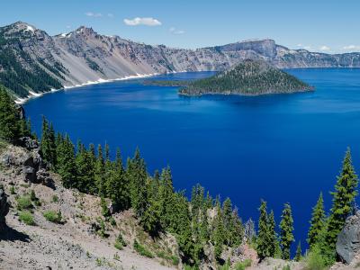
Wizard Island
Volcanic cinder cone rising 755 feet above Crater Lake
Natural Wonders · Geological Sites
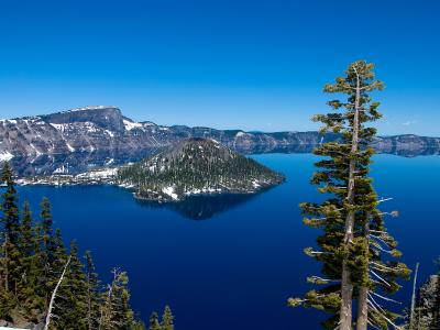
Discovery Point
Historic rim overlook with views of Wizard Island and deep blue waters
History & Heritage · Natural Wonders
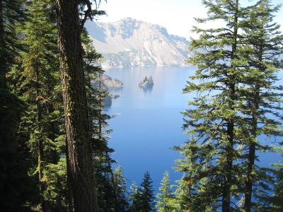
Phantom Ship
Dark jagged volcanic islet resembling a sailing ship
Natural Wonders · National Parks
Crater Lake by interest
The same sights, grouped by what you came for.
Did you know?
Checked facts about Crater Lake, each with its source.
-
Trivia
A 30-foot log has floated upright here since 1896
The 'Old Man of the Lake' is a 30-foot mountain hemlock log that floats vertically, with about three feet above water. Geologist Joseph Diller first recorded it in 1896, and a 1938 study found it drifted 62.1 miles around the lake in a single summer.
Source: National Park Service
Planning a visit to Crater Lake
Itineraries that include Crater Lake
Good to know
- Currency
- USD
- Language
- English